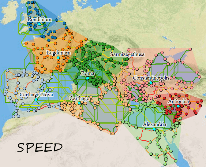
This page serves as a showcase for Digital Humanities projects that use GIS and DVA to illustrate patterns in ways that are innovative, attractive, and hard to duplicate in traditional scholarly media. The Animated Slave trade map uses a time slider to show the journeys of all known slave ships from 1560-1860. Pause and click on a dot to see the name of the ship and other information. The Valley of the Shadow battle map follows units from two towns throughout the American Civil War. Orbis, a project from Stanford University, allows the user to calculate the difficulty, time and expense of any journey in the Roman Empire, 200 CE. Hestia is a tool that maps all places mentioned in Herodotus' Histories, as well as showing the frequency that each place occurs in the text, and relationships to other places mentioned with it. Mapping the Republic of Letters: Alembert is just one example of a data visualization of an author's correspondence from this fascinating site. The Pelagios Project is a more general and adaptable tool for those wishing to view a map of the ancient world in context with other digital resources in Classics. Finally, the StoryMaps demo is an example of work that the relative beginner may achieve with the StoryMaps platform by Esri-telling a story that combines maps, imagery, and words in a dynamic interface.